Route · 6 stops
Volcano Route
Volcanoes, lava fields and a visitor center to get to know the volcanic landscape of Fuencaliente.
Route map
Use ⌘/Ctrl + scroll to zoom · two fingers on touch screens
Discover the route
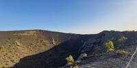
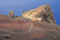
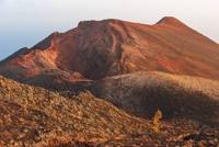
Fuencaliente is the volcanic municipality of La Palma: four of the island’s historical eruptions took place here. That of 1646, from the Martín volcano and El Búcaro, which opened vents on the summit and on the coast of El Puertito; that of 1677, from San Antonio, which buried the Fuente Santa that gives the municipality its name; that of 1712, from El Charco, with up to twelve vents at once; and that of 1971, from Teneguía, the last surface eruption in Spain until 2021, which gained land from the sea and created Echentive beach. The San Antonio Volcano Visitor Centre is the best starting point. This themed selection also includes the GR 131, the Ruta de los Volcanes, but it is not the same as that hiking trail.
Before you set off
- Check for closures, weather alerts and fire risk.
- Stay on the marked trails and do not remove volcanic material.
- Bring water, sun protection and suitable footwear.
- Opening hours, fees and access should be checked with the official sources.
To print (offline) and listen
This page is also available as a printable document and as audio.