Trail · 6 stops
Trail 4: Los Canarios – El Faro
Municipal trail from Los Canarios to the Fuencaliente Lighthouse, between the San Antonio and Teneguía volcanoes and the salt pans.
Route map
Use ⌘/Ctrl + scroll to zoom · two fingers on touch screens
Discover the route
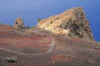
From Los Canarios to the Fuencaliente lighthouse between the San Antonio and Teneguía volcanoes: a descent through scrub, vineyards and lava flows to the southern tip of the island, with the salt pans and the two lighthouses at the end. It coincides for most of its length with the last section of the GR 131, the Volcano Route.
Fact sheet
- Start: Plaza Minerva (Tourist Office), Los Canarios, at 715 m.
- End: Fuencaliente lighthouse.
- Distance: 8.05 km.
- Cumulative descent: 742 m.
- Duration: 2 h 45 min.
- Difficulty: moderate to low; poles are recommended.
The route
From Plaza Minerva take the Carretera General to the right and the second street on the right, descending for about 350 m. Following the signs, about 150 m further on the path descends through low scrub and the first vineyards appear. Looking up, on clear days you can see the island of El Hierro in the distance.
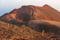
The descent crosses the most important vineyard area of Fuencaliente, where Malvasía grows, the wine that gave the municipality international fame. Before going on, it is worth stopping to look, on the right, at the Teneguía volcano: its eruption of 1971 was the last surface eruption in Spain until that of 2021.
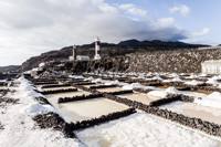
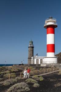
The path continues between the lava flows to the Fuencaliente lighthouse. The walk ends there, and it is worth setting aside time for the Fuencaliente Salt Pans, with a self-guided visit, and for the Marine Reserve Interpretation Centre, in the old lighthouse. El Faro beach, with its old fishermen’s houses, is the place for a swim.
How to get back
The line 23 bus (Fuencaliente – Hotel – Faro) leaves from the lighthouse; you can also book a taxi.
Before you start
- Bring comfortable clothing, poles, a cap, sun cream, water and food.
- There is little shade beyond the vineyards: better to set out early in summer.
- Climbing the Teneguía cone is prohibited; it is viewed from the trail.
- Emergencies: 112.
To print (offline) and listen
This page is also available as a printable document and as audio.